
By Wesley Alexander • August 10, 2026 • 8 min read
For years the wildfire Temporary Flight Restriction ran on an honor system with a threat attached. The FAA published the TFR, agencies posted "no drone zone" signs, and enforcement depended on someone on the ground physically spotting a drone and tracing it back to a pilot. Over the Spokane Complex fires, that honor system is gone. The FBI Counter-UAS Task Force has deployed detection equipment that logs every unauthorized aircraft entering the restricted airspace, and the numbers it produced in the first days are the reason every operator flying anywhere near a fire needs to reread this one.
What Actually Happened Over Spokane
The Autumn Lane, Fairview, and Old Trails fires ignited on August 1, 2026, in Spokane County, Washington, and burned across roughly 10,280 acres with zero containment by the morning of August 4, forcing evacuations north of the city. The FAA issued a Temporary Flight Restriction over the fire area that applies 24 hours a day to all unauthorized aircraft, including drones.
On August 5, Spokane County Sheriff John Nowels and Deputy Doug Hicks, a member of the FBI Counter-UAS Task Force, held a public briefing to explain what was being deployed. According to the Washington State Patrol's press release, the task force fielded "specialized equipment capable of detecting unauthorized drones operating within the 24-hour restricted airspace." The task force includes members from the King County Sheriff's Office, the Spokane County Sheriff's Office, the Seattle Police Department, the Spokane Valley Police Department, and the Washington State Patrol.
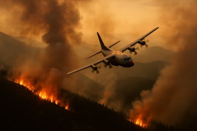
The detection numbers are the part operators should sit with. WSP reported that on August 2 the system detected 26 unauthorized drones, followed by 13 more on August 3, causing aerial firefighting to stop at least once. That is 39 incursions in 48 hours over a single fire complex. Spokane County reporting indicates several of those drones crossed directly into the flight paths of aircraft dropping water and retardant, and that the Sheriff's Office has already identified multiple operators through flight-path analysis and witness reports, citing at least two and referring the cases to the FAA.
Why Detection Changes the Risk Math
Interfering with wildfire suppression by drone has always carried a heavy statutory penalty. The FAA can pursue civil penalties up to $75,000 for a UAS operation that interferes with firefighting, on top of possible criminal prosecution, and a TFR bust can drag a Part 107 certificate into suspension or revocation. None of that is new.
What is new is the probability of getting caught. For most of the last decade, the practical enforcement rate on wildfire TFR violations was low because attribution was hard. A drone at altitude a mile from the incident command post was, for enforcement purposes, anonymous. The Spokane deployment inverts that. Purpose-built counter-UAS detection systems capture the drone and, in many configurations, the location of the ground controller. When that telemetry is paired with witness reports and flight-log subpoenas, the "they will never trace it to me" assumption collapses.
This is the same enforcement escalation we have tracked in the FAA's broader 2026 posture. The agency has moved away from its old education-first compliance philosophy toward automatic legal referral for airspace violations, a shift we covered in detail in our analysis of the 2026 FAA enforcement crackdown. Detection technology is what turns that policy from a paper threat into a field reality.
The Operational Reality for Legitimate Operators
Here is the uncomfortable middle. The 39 incursions over Spokane were almost certainly not commercial operators running deliberate missions. They were hobbyists chasing footage, news-adjacent flyers, and people who genuinely did not check for a TFR before launching. But the detection net does not read intent. It reads position. A licensed operator working a legitimate job near the fire perimeter is a data point in the same system that flags the reckless hobbyist.
That matters because wildfire TFRs are large, they move, and they are issued fast. A fire that was not there yesterday can put a multi-mile restricted cylinder over a job site you scheduled last week. If you are running mapping, inspection, or public-safety support anywhere near active fire behavior, your pre-flight has to treat TFR status as a live, changing input, not a box you checked at the office.
Practical discipline for anyone operating in fire-prone regions this season:
- Pull the TFR at launch, not at planning. Check the FAA TFR list and B4UFLY within minutes of takeoff, and re-check on any multi-sortie day. A morning briefing does not cover an afternoon fire.
- Know the shape of the airspace. Wildfire TFRs are typically defined by a center point and radius up to a ceiling. Log the coordinates and ceiling in your flight record so you can prove you planned around them.
- Do not assume LAANC clears you. LAANC authorization for controlled airspace does not override a TFR. We broke down that exact trap in why LAANC does not override a TFR, and the principle is identical here.
- If you are supporting the incident, get on the ATO. Authorized public-safety and aerial-firefighting support flies under an FAA-coordinated Air Tactical Group Supervisor. There is a legitimate path into that airspace, and it runs through the incident's aviation management, not around it.
- Document your deconfliction. In an enforcement proceeding, your NOTAM checks, your recorded coordinates, and your decision not to launch are the evidence that separates a professional from the 39.
The Bigger Signal: Counter-UAS Is Moving to the Fireline
Step back from Spokane and the pattern is clear. Counter-UAS detection, which two years ago was concentrated around stadiums, airports, and VIP movements, is now being pushed to routine emergency incidents. Wildfire is a natural fit: the airspace is already restricted, the public-safety justification is airtight, and the interference is measurable in grounded tankers. Expect this to become standard practice on major western fires, and expect the detection data to feed directly into FAA enforcement referrals.
For the industry, this cuts two ways. It is a genuine threat to the reckless minority whose footage flights ground firefighting aircraft and endanger crews, and that is a legitimacy problem the whole sector has needed to solve. But it also raises the compliance bar for legitimate operators, who now fly in an environment where their position is being actively logged by federal and state task forces. The operators who treat airspace compliance as an active risk-management discipline will be fine. The ones who treat it as a formality are about to meet the detection system. For the counter-UAS authority framework underneath all of this, our breakdown of the SAFER SKIES state and local counter-drone rule covers who can now detect, and who can act.
The Spokane deployment is a preview, not an outlier. Fly like you are being detected, because over an active fire this month, you are.
UAVHQ Analysis: The Spokane Complex counter-UAS deployment marks the point where wildfire TFR enforcement stops depending on eyewitnesses and starts depending on sensors. Attribution risk, not statutory penalty, is the variable that changed. Operators working fire-prone regions should rebuild their TFR check into a launch-time, re-verified step and document deconfliction on every sortie. We will update as the Spokane cases move through FAA enforcement.
Sources
- Restricted Airspace Surrounding Spokane Complex Fires to Protect Firefighter Operations, Washington State Patrol (August 5, 2026)
- FBI Counter UAS Task Force Briefing, Spokane County (August 6, 2026)
- Unauthorized drones disrupt firefighting efforts at Spokane Complex fires, KXLY / Apple Valley News Now (August 2026)
- FBI Seattle TFR Advisory, Spokane County Wildfires (August 2026)
📺 Watch the Video Briefing
Get expert video analysis on this topic and more on the UAVHQ YouTube channel.
🚁 Stay Ahead of the Drone Industry
Expert analysis on FAA regulations, commercial operations, and emerging technology — delivered to your inbox.
Subscribe
Consulting Intake Paused
UAVHQ is not currently accepting new consulting clients. Existing commitments remain supported; select time-sensitive safety or regulatory inquiries may be reviewed as availability allows.